

Wildererweg Pyhrn-Priel - Adventure


- pets allowed
Interactive elevation profile
Create PDF
Tour-Details
Starting place: 4575 Roßleithen
Destination: 4582 Spital am Pyhrn
duration: 1h 30m
length: 4,5 km
Altitude difference (uphill): 833m
Altitude difference (downhill): 155m
Lowest point: 805m
Highest point: 1.563m
difficulty: difficult
condition: difficult
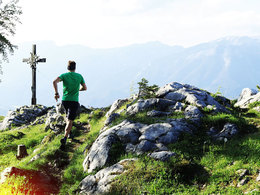
panoramic view: Great panorama
Paths covering:
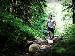
Gravel, Hiking trail
powered by TOURDATA
information: Game APP
Description: The app for the Wildererweg is no longer available!
Poacher trail adventure - the Fürst Schwarzenberg Run is a steep mountain run for sporty adventurers.
Top spot? Either way: you are sure to be named in the "Hall of Fame" of poacher trail conquerors.
ZUM HISTORISCHEN HINTERGRUND
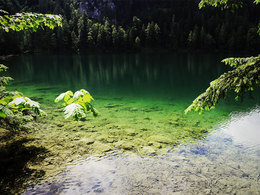
Starting point: Lakeshore at Gleinkersee
Destination: Summit of Seespitz am Schwarzenberg
Details - hiking
- themed path


Accessibility / arrival
A9 - Exit Roßleithen - B138 direction Windischgarsten - exit Windischgarsten Center - follow from there the signs to Gleinkersee.
- Charging point for e-bikes (free of charge)
- Suitable for groups
- Pets allowed
- Suitable for teenagers
- Suitable for single travelers
- Suitable for friends
- Suitable for couples
- Spring
- Summer
- Autumn
Please get in touch for more information.
Stiftsplatz 1
4582 Spital am Pyhrn
Phone +43 7562 5266
E-Mail info@pyhrn-priel.net
Web www.urlaubsregion-pyhrn-priel.at/wa…
https://www.urlaubsregion-pyhrn-priel.at/wandern/themenwege/wildererweg-pyhrn-priel.html
")
")
")
")
Interactive elevation profile
Create PDF
Tour-Details
Starting place: 4575 Roßleithen
Destination: 4582 Spital am Pyhrn
duration: 1h 30m
length: 4,5 km
Altitude difference (uphill): 833m
Altitude difference (downhill): 155m
Lowest point: 805m
Highest point: 1.563m
difficulty: difficult
condition: difficult
panoramic view: Great panorama
Paths covering:
Gravel, Hiking trail
powered by TOURDATA